- Subscribe to RSS Feed
- Mark as New
- Mark as Read
- Bookmark
- Subscribe
- Printer Friendly Page
- Report Inappropriate Content
“Are you crazy?!”
I get that a lot when people find out that I used to fly into hurricanes as a meteorologist and loadmaster. I’m an adrenaline junkie, so maybe it’s not so much being crazy as it is enjoying the ride and the spectacular show that Mother Nature can display.
Years ago, an Air Force recruiter decided that I would end up in the weather field for my career, and little did I know where that would take me. Early in my career I discovered a band of weather warriors based out of Biloxi, MS and decided that I would join them someday. The squadron is actually an Air Force Reserve squadron, which meant I had to wait until I got off of active duty to join. After an interview with the Chief in charge at the time, I made that easy decision to do what it took to get trained and ready to fly into storms. Yes that’s what I said, into them!
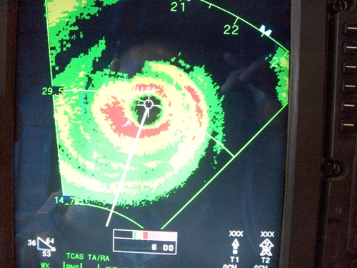
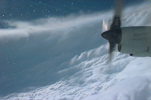
Flying into a tropical storm, not over it, can sometimes be fairly uneventful and at other times, you get to experience strong turbulence that rocks the plane. The engines groan as they fight the up- and downdrafts. While our Southwest pilots go out of their way to avoid weather, the crews on these WC-130 aircraft purposely track towards the eye of the storm. Two of our current Southwest pilots, Captain Chris Patrie and First Officer Jason MacDonald have plenty of experience flying into hurricanes as well. Thankfully, weather radar as well as many weather sensors onboard the aircraft help the crew to stay on track.

Storms like Hurricane Georges toss anything not strapped down in the back of the plane around like children’s toys. In many storms, I’ve experienced just the light choppiness that feels as if you’re driving your car down a washboard dirt road, but for 12 hours. They’re a long 12 hours that even after you land, leave you feeling motion sensations as if you’d been on a boat all day.

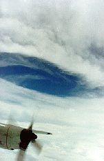
Each storm is completely different from the others. There are a few constants, but each one has its own personality, so to speak. One of the most spectacular things you can see in some of these massive, perfectly formed hurricanes is what is called “the stadium effect” where the rotation of the clouds within the eye itself makes it look as if you’re in the middle of a baseball or football stadium looking up. The clouds are curved tightly and in a way, they curve back in towards the center towards the top. When it’s especially clear, you can see the nearly calm seas below you and blue sky above. It’s a spectacular sight that few people get to see.

“Why in the world do you do it?” is another question frequently asked. The real purpose behind the group is to not only track the position of the storm, but the changes happening within the storm with the pressure, winds, and temperatures. They start tracking many times when a storm is just forming as a tropical storm all the way through its lifecycle until it makes landfall. Any minor changes could be a sign of major changes happening to forecasters on the ground at the National Hurricane Center (NHC). Satellite imagery is a great tool, but it can’t detect the nuances of the storm itself, and radar detection only goes out so far off the coast. The NHC not only keeps an eye on the coastlines, but major air routes off the East and West coasts of the U.S. as well.
I’ve been retired for nearly four years now, but I still get a little twang to go fly when I see a tropical storm starting to brew over the water. I suppose it’s a bit like being a retired firefighter seeing flames; you just want to be in the action and helping people.
For more information about hurricanes, visit the National Hurricane Center’s site or visit the Hurricane Hunters home page for more information about the folks chasing these beasts.
You must be a registered user to add a comment. If you've already registered, sign in. Otherwise, register and sign in.